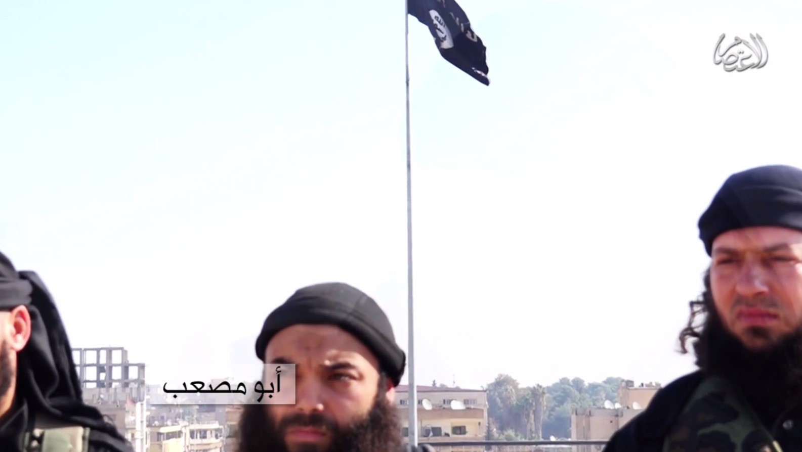
Earlier this week a video was posted online showing Tunisian Jihadists claiming responsibility for the murders of two Tunisian secular politicians in 2013. It was claimed that the video was filmed in territory controlled by the Islamic State, and using a variety of geolocation techniques it is possible to find the position the video was filmed.
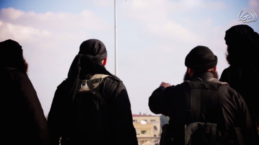
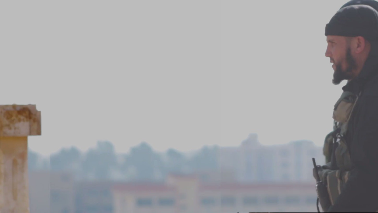
The video is heavily edited, and includes the statements of the men filmed from multiple angles. 39 seconds into the video there’s a shot of a flag pole with buildings visible in the background.
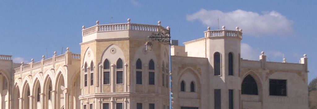
One building was of particular interest, the large red roofed building just behind the flag pole. The same building is also visible at the opening of the video (around 28 seconds onwards), when the four men sit down, revealing more details about the building.
Using simple picture editing software such as Paint.net it’s possible to create a composite image of that scene showing all the buildings in the background, providing a clearer view of the building.

Based on this we can see we are looking for a large building with a red roof, with rectangular windows on the top floor, and at least two floors with arched windows below that.
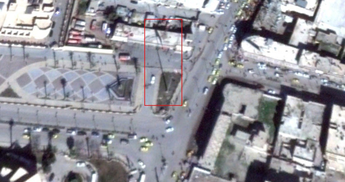
We then began looking at satellite map imagery of the cities controlled by the Islamic State, starting with Raqqa. We quickly found one large red roofed building, the Faculty of Civil Engineering, and began to look for any images of the building. It was possible to find images of the building on Panoramio, and compare the photographs to the building visible in the video.

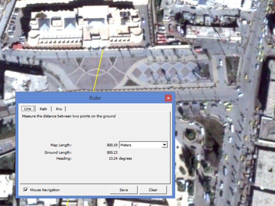
Three hundred meters west of this building is a public square with a large flag pole visible, with the shadow cast by it and the flag visible in the below satellite map imagery.
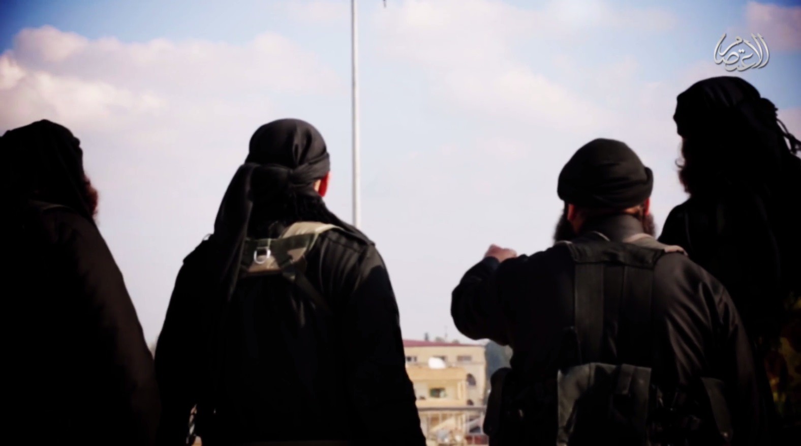
Also from the start of the video is a short section where the men are shown entering the frame from the right, giving a different view from the filming location. It was possible to create another composite image of the buildings in the background using simple picture editing software.
South of the public square satellite map imagery shows a building that matches to what’s visible in the above image. In the below image, the top satellite image shows the red paint around the edge of the roof. In the bottom satellite image, taken from 2011, the north side of the building is visible, and the pattern of windows visible in the video match to that visible in the satellite map image.

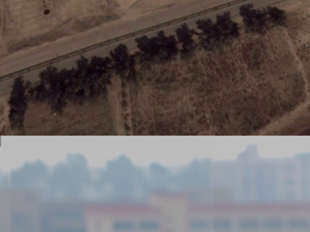
To the south-west of the above building is another building visible in the composite image. A number of elements are a clear match, including the position of the windows on the front of the building, and the structure on the top of the building.
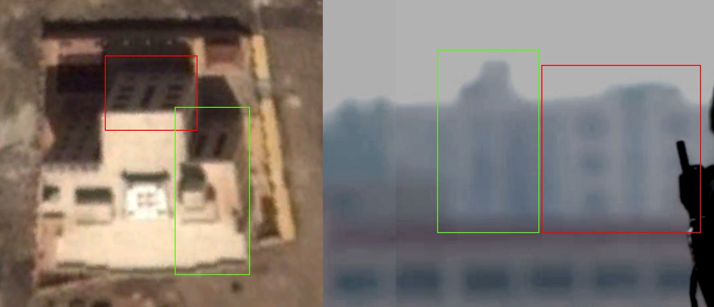
Also visible are the trees behind that building, and all of these elements suggest this location is an extremely strong match to what’s visible in the video.
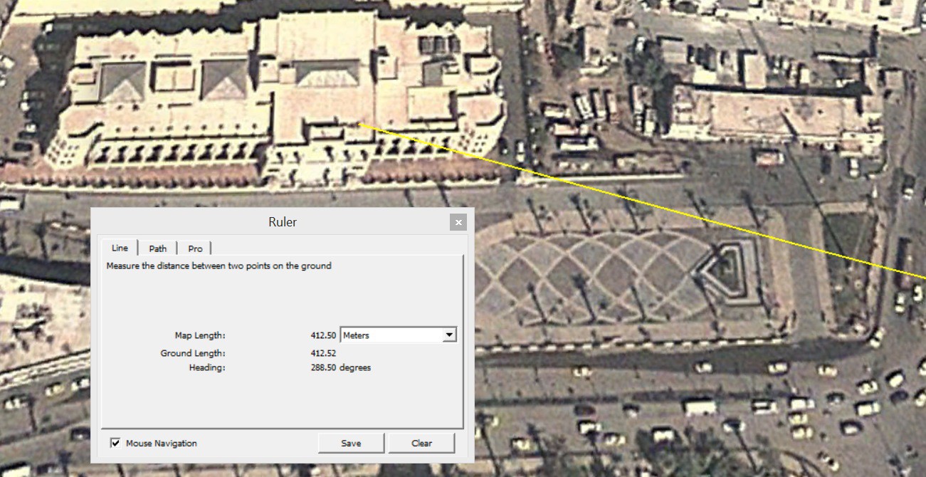
It was also possible to estimate the position of the camera from the above image. As it’s possible to see the exact parts of the two buildings that line up with each other it’s also possible to draw a line between them which points towards the camera’s location. In the below image a line has been drawn between the areas on the building marked red and green, which corresponds with the position on the satellite map imagery.
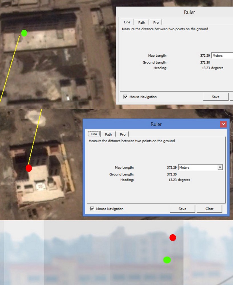
Following the line northwards along the same heading it points towards the same location west of the Faculty of Civil Engineering that we found earlier. It seems based on this information it’s very likely the video was filmed somewhere in that location.
At this point it’s worth noting an object in the background in the video.
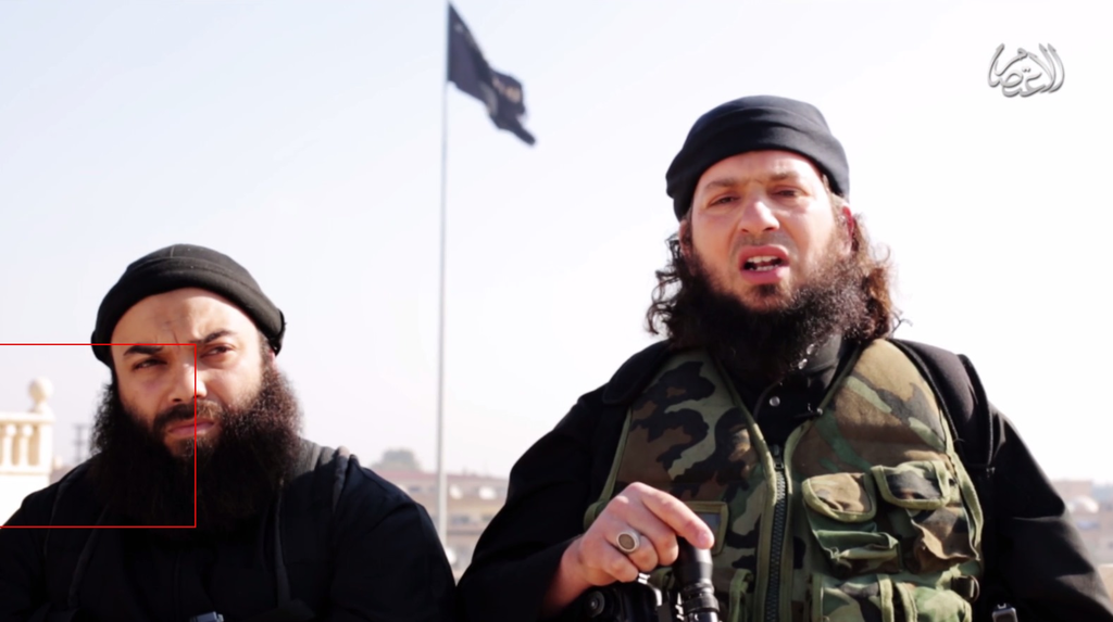
This balcony belongs to the Raqqa Governorate building, is exactly in the same spot as the line we drew from the two buildings in the south, and is shown in the below image.
Based on this information alone it seems very likely the video is filmed on the roof of this building. It’s also possible to find additional information pointing to this location. In the below image we can see the flagpole lines up between the windows 3rd and 4th from the right corner of the top floor of the Faculty of Civil Engineering building.
As with the other buildings it’s possible to draw a line from that position, through the flagpole, pointing to the location of the camera.
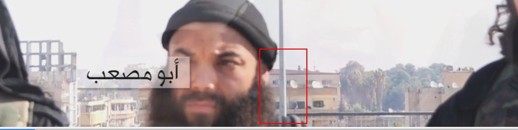
This again points to the same location as before, and confirms the video is being filmed from the roof of the Raqqa Governorate building, currently occupied by the Islamic State. It’s also possible to establish this video was filmed after a specific date. In one section of the video an antennae is visible, one of a pair that were just east of the Governorate building.

In late September one of the two antennae was destroyed in an air strike, so it’s possible to confirm that this video was filmed not only on the roof of the Raqqa Governorate building, but also after late September 2014.
Eliot Higgins from Bellingcat first published this on December 19, 2014. We have reproduced it here as part of The First Draft collection.