UPDATE: This article has been updated with comment and clarification from Google about how and when the closure of Panoramio will affect images in Google Earth.
Panoramio, the Google-owned image-hosting service central to many verification and geolocation efforts, is to go into “read-only” mode from November 4th and close permanently in November 2017.
All Panoramio photos which appear in Google Maps will remain there, according to an announcement on the Panoramio website, but the 94 million images which appear in Panoramio itself will no longer be supported. All Panoramio images transferred to Google’s Local Guides program will appear in Google Earth after November 2017.
“We love the community that has grown around contributing imagery to Google Earth,” a Google spokesperson told First Draft in an email, “and we are working on a new solution.
“Our intention is to replace the Panoramio layer in Google Earth with a photo layer that is powered by imagery from Local Guides. In the meantime, the Panoramio layer will continue to work during read-only mode, but without new photo submissions.”
People can continue to upload images to Google Maps, and users who link their Panoramio and Google accounts will have all their images automatically transferred to the Google Album Archive when Panoramio is fully retired next year.
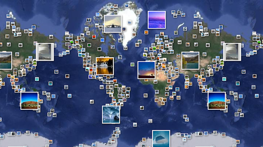
Google Earth moderators currently add verified images from Panoramio to Google Earth on a weekly basis, where they appear as clickable icons. These images have regularly been used to support verification efforts in areas with little other local imagery.
In 2015, journalists at Egyptian news site Madr Masa used Panoramio imagery on Google Earth to verify an incident at a cement factory in the middle of the Sinai desert.
A video uploaded to Facebook alleged to show the Egyptian army shooting at protesting workers at the Arish cement factory. Panoramio images corroborated the location of the video, but the same images do not appear in Google Maps and there is no StreetView imagery of the region.
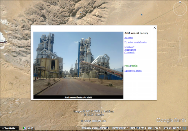
Screenshot from Google Earth
In another investigation, First Draft partner Bellingcat found pictures alleging to show a Daesh training camp in 2014.
Using Panoramio imagery on Google Earth, they were able to verify the location of the training camp in Mosul, Iraq. Again, these images do not appear on Google Maps and there is no supporting StreetView imagery.
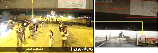
Image via Bellingcat
The impending closure of Panoramio is the latest in a string of disappearing online tools for journalists which have previously been essential in the discovery and verification of eyewitness media and other online imagery.
In June of this year, API changes at Instagram almost instantly nullified a number of tools used to find Instagram posts by location. Now, only a selection of paid-for tools and Facebook’s Signal search platform carry the function.
In December 2015 Apple closed Topsy, a Twitter analytics service which also served as a detailed and powerful search tool.
Follow First Draft on Twitter and Facebook for the latest updates in newsgathering, verification and hoaxes.